What’s an awesome trail hike without sharing it with friends and family on Instagram? Not only can you claim bragging rights but you help them get the most from their next visit to the McDowell Sonoran Preserve. So where are the best places to snap your epic picture? Get our list of the best hiking trails for Instagram photos. Then share your shots using #MSConservancy.
The Preserve offers more than 200 miles of prime desert habitat to explore. It’s open from sunrise to sunset and the trails are dog friendly, when they’re on leash. Put your best face forward with our picks for the best Instagram spots.
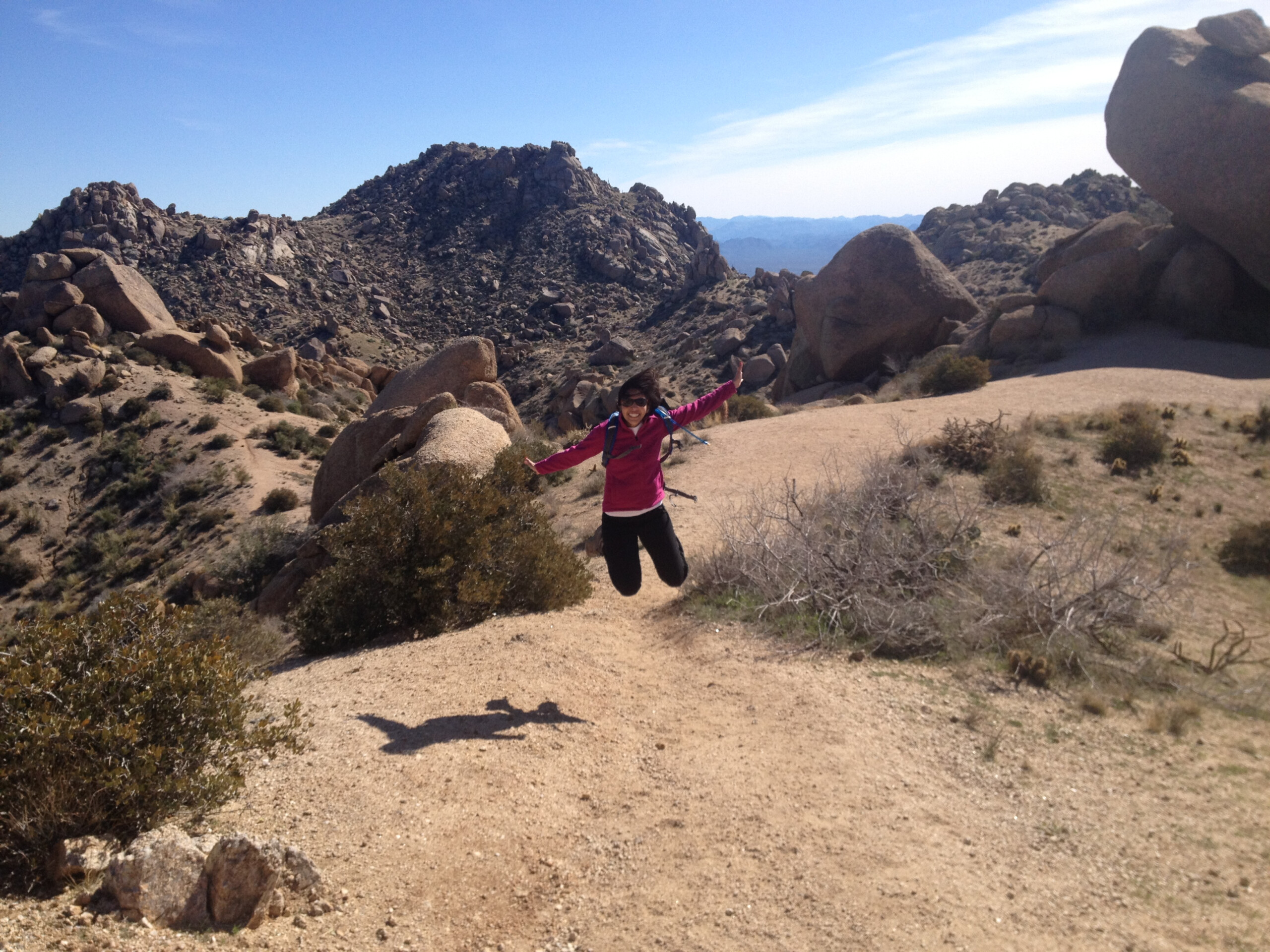
- Marcus Landslide
This is a gentle 3-mile out-and-back hike with an optional 0.7-mile loop. You’ll get views of Four Peaks, Mount McDowell, and Weaver’s Needle. And it ends on top of the second largest landslide in Arizona (look for the mushroom rocks). Any of these is an excellent photo op.
If wildflowers are your thing, snap photos of the bloomed magenta cacti when they’re in season. Here are directions to this trail.
- Tom’s Thumb
Tom’s Thumb is a well-known classic in the Preserve. It’s one of the more challenging trails stretching 11 miles with a 2,500 elevation gain. But it’s well marked with many signs to keep you going in the right direction.
At the end, the trail opens up to panoramic city views, perfect for snapping a prized Instagram photo. Cap off your accomplishment with another picture in front of the elevation sign—go ahead, you earned it! Here’s more information on what to expect on this trail.
- Cathedral Rock along the Cholla Mountain Loop
Cathedral Rock is a collection of tilted monoliths and grottoes. Use Brown’s Ranch Trailhead to reach it. You’ll see well-marked signage for this 3-mile hike but feel free to grab a paper map to bring with you!
This area doesn’t look very photo-worthy until you’re up close. There are window-like openings behind the scenic formations and crags. You’ll also see metates used by ancient dwellers of the area. Peer through a window and snap a photo.
- Balanced Rock near Granite Mountain
Balanced Rock is a large boulder standing unbelievably upright on bare stone. Take a fun photo standing at the base pretending to holding up the rock. This location is surrounded by open space with cacti backgrounds. Decorate your home or office with these photos. They’ll remind you of the fun you had.
Start at the Granite Mountain Trailhead. To reach the trail directly, hike 1.2 miles on Powerline Road to the Balanced Rock Trail junction. From there, hike 0.9 miles to the rock.
- Gateway Trail
Gateway Trail has perfect scenic views to show off the desert landscape. There isn’t one specific wow spot—the entire trail offers beautiful views of the Sonoran Desert. Gateway offers very rocky terrain, perfect for showing off that out-of-the-city feeling.
Begin at the Gateway Trailhead and follow signage to the 4.5-mile Gateway Loop. You can choose between starting on the left or the right, both connect to the same location. The 650-foot elevation increase is almost in the middle of the loop.
Instagram Tips
Never posted on Instagram before? No worries, it’s easy. Just download the Instagram app on your phone. Here’s a quick tutorial to get you started. Be sure to include the hashtag #MSConservancy so others will be sure to see it.
Enjoy your picture-perfect time at the Preserve.